Our base camp was at the village of Airnanang, adjacent to the mangroove swamps where we collected our paleoclimate cores. There are, conveniently, several villages within walking distance up the coast from Airnanang. It’s central location between the mangroove swamps and multiple villages is one of the reasons we chose that village as our base camp. Airnanang is also very accessible by boat and offers easy access to the neighboring islands of Seram Laut and Gesar – a fact not lost on local government and infrastructure planners. Airnanang will soon be even more accessible – a ferry dock connecting it to Ambon and other large ports is currently under construction.
Although archaeologists generally study past cultures, our research requires us to talk a great deal with living people, especially those who reside near the archaeological sites we want to study. So before any digging happens, we meet with local people to discuss what we’d like to learn from the archaeology in their backyards. Archaeological research is always easier (and FAR more ethical) to do when you have the permission and acceptance of the people whose past you’d like to study. The goal of this trip to Seram was to collect paleoclimate data and get a sense of the archaeology of the region, but it was also about building relationships and connections with the people in this area, with the hopes that they will be open to us coming back to do more archaeological research in the future.
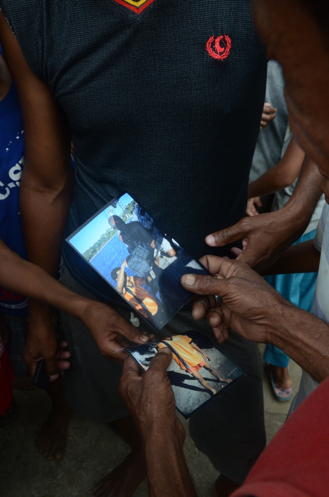
Over a period of a few days we visited both Rumadan and Kwaos, two villages neighboring Airnanang. Peter Lape (fearless leader of the UW archaeologists) had actually visited Rumadan previously during his dissertation field work in the ‘90s and had brought old photographs of the village and people he had met with him on our trip. During our visit we managed to find someone from the photographs. Twenty odd years later and this person was still around AND remembered Peter! Building connections for the win!
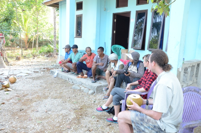
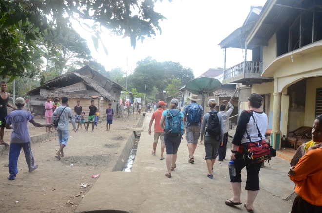
Our initial visits with each village usually entail a group of us landing on the beach, or strolling out of the woods en masse. A group of foreigners and Indonesians from Jakarta is definitely a strange sight for the people who live in these villages. Once we’ve announced our presence (it’s usually pretty obvious we don’t belong there), we ask to speak with the kepala desa (village leader) or elders to pay our respects, inform them about our research plans and goals, and lastly ask permission to do research and take suggestions/advice on where we should focus on efforts. All these usually involves lots of very sweet tea, snacks, and acquiescing to many, many photographs with village residents.
Once we got permission to do our research, we often broke up into groups to accomplish various tasks. At each village, a few of us went searching for clay sources with the help of village pottery makers. One of the project goals is to figure out where people in the past were collecting the clay used to make ceramics. If we’re able to match up the chemical signature of clay sources to archaeological ceramics, we might be able to say something about how Neolithic people made and traded ceramics in SE Seram.
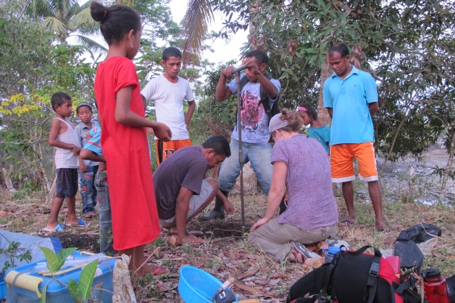
At Rumadan and Airnanang we dug a few auger holes to see if there were artifacts in the area. We were especially interested in finding pottery fragments, as that might mean there are Neolithic age sites that we could explore to answer our research questions. Another group of us might break off to explore the areas surrounding the villages, especially if the village elders informed us that there were possible sites. It seems to have been practice in SE Seram before the 1700s or 1800s for villages to be located further inland from their current coastal locations, so if elders told us stories about the kampung lama (old village), we definitely wanted to explore that.
The act of getting permission to do research is really relevant for exploring areas outside of the village. Rumadan’s kampung lama, for instance, is located in a different political district, so the elder of Rumadan was not able to give us permission to explore it this trip. Perhaps next time! Supposedly there is a stone tool source somewhere upstream near the kampung lama, which might be able to answer some of our questions about where all the stone sources for tools was coming from.
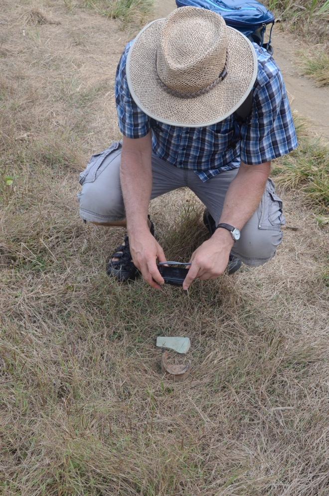
At each village location we were fortunate to find an abundance of stone tool and pottery fragments scattered around the surface of the village and surrounding areas. Some of the pottery is Chinese and European tradeware – dishes, cups, plates, and other ceramic items that were traded with local people during the 13th-19th centuries. Tradewares are excellent ways of figuring out how old a site is, because the “fashions” and styles of Chinese porcelain and European ceramics changed very often – and the dates and styles of these changes were nearly always recorded in historical documents. There were also plain ceramics similar to those we’d expect to see from about 3000 BP, so it’s very likely that there are Neolithic-era sites in all the villages that we explored.
We’re currently waiting to hear back from our partners at the Field Museum in Chicago on the chemical signatures of clay sources’ we collected at all these villages. We’re also dating stone tools that were collected at these villages at the UW’s Luminescence Dating Lab. You can read more about how thermoluminescence dating works here.
All photographs by Marlon Ririmasse.
