Cataloguing and packing: final steps and the long flights home

Archaeologists divide time in thirds. For every third unit of time you spend in the field, budget two-thirds units of time for cataloguing and describing artifacts, conducting the research, and writing up your results. We had spent two weeks in the field, so extending this 1:3/2:3 principle, we could expect six weeks of post-fieldwork work in the lab analyzing and organizing the artifacts and samples we brought back. Naturally, we had two days in Ambon to accomplish this.

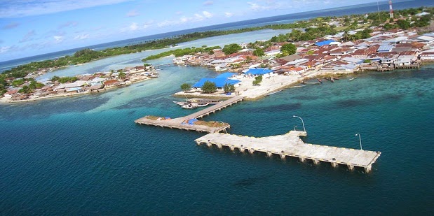
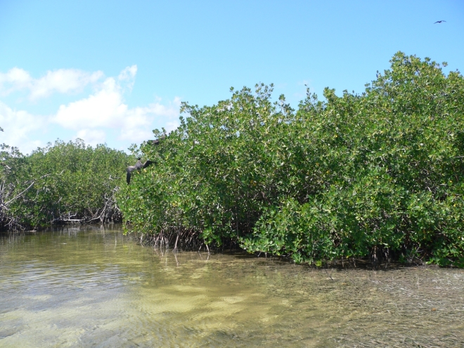
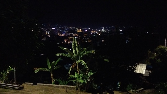
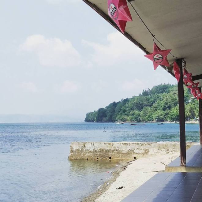
It wasn’t all bad. This was our the view from our “lab”:

12144693_1075325425834095_785796719208383523_n

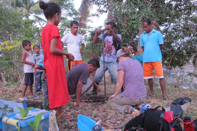
We essentially set up shop at the hotel’s restaurant, laid out all our artifacts and samples, and got to work cataloguing them.

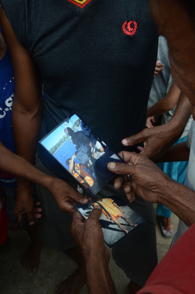
The cataloguing process involves giving every artifact or sample an accession number, essentially a unique ID that we enter into a database. We then photograph and do a basic description (a more complete description will be added to the database before the artifact/sample is analyzed) of each item.

P1000961.JPG
Photograph of artifacts after it’s been accessioned and described.

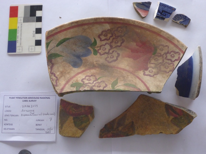
Once we’ve finished cataloguing the artifacts they are prepped for shipment back to the US or for curation at an Indonesian facility. Some artifacts, for example, a lot of the ceramics like the ones in the picture above, were curated (stored in a museum-like setting) at Balai Arkaeologi in Ambon. Others, like the leaf samples, mangrove core samples, and artifacts we thought might date from 3500 BP, returned to the UW with the US based team for further analysis.

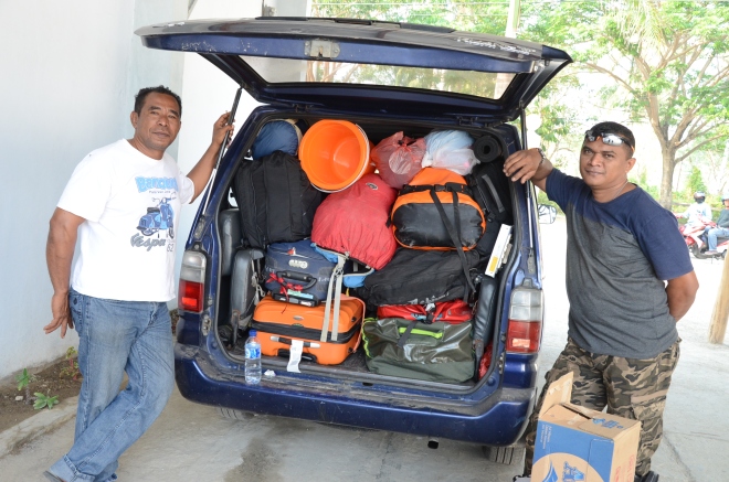
Packaging the artifacts for travel back to the US was quite the feat. Some items had to be “hand-carried” into the US. The mangrove and leaf-samples, for example, have to go through USDA and US customs before being stored at the University of Washington.

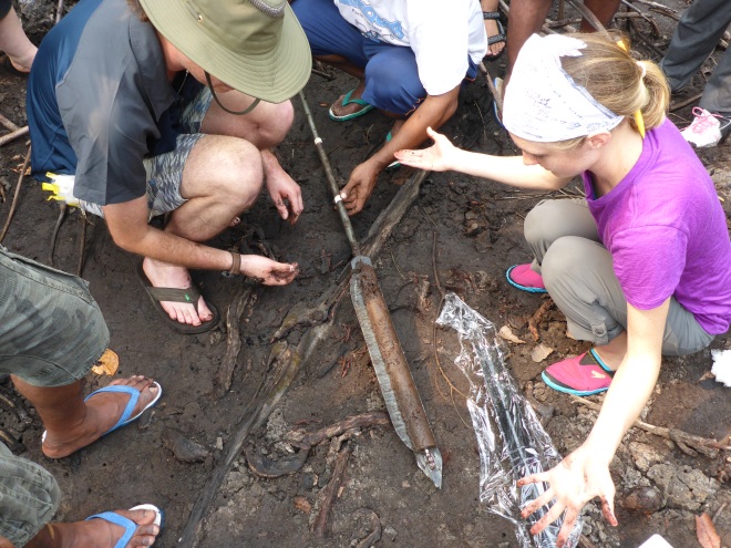
I’d like to remind you at this time that the mangrove samples are stored in 1 meter long PVC pipes that have been duct-taped together. We had to hand-carry these back into the US. I also had to explain in Indonesian to Indonesian TSA that these were, in fact, perfectly safe and legal to bring on the airplane.

imag3150
Officer, these are in no way suspicious.

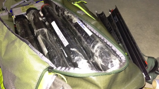
Good news, we successfully imported all our samples and artifacts back home. Bad news, I may or may not get flagged by customs every time I travel internationally now.

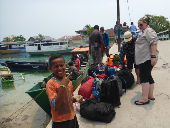
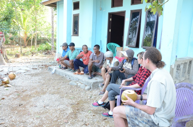
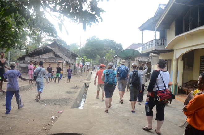
After packing everything up in Ambon, our crew split up. Joss continued onto the Aru Islands to do some pilot research on his dissertation work. He has an excellent blog detailing his Indonesian adventures, called Improbable Artifacts. Definitely worth checking out. Peter traveled to Bali on a mission to find a traditional boat builder for a joint Alaska/Indonesia boat collaboration. Jenn, Emily and I returned to Jakarta for a day or so before beginning our long trek home to Seattle by way of Taiwan. In Taiwan we realized we needed to find a business center to print some last minute USDA permits, and then quickly experienced reverse culture shock as we remembered we could ask the concierge in English! Readjusting to English as the de facto language was incredibly bizarre.

Returning to Seattle and DC (in my case) mid-November from 90+ temperatures and humidity was also a little difficult.


……Epilogue…..

You’ve made it! This is the last post retelling the stories from our 2015 field season! We’re currently analyzing these samples:

  1. Mangrove cores. Our colleagues at UW were very excited to receive old dates on the 1.5 meter long core that we collected. We’re currently running additional radiocarbon dates and completing the isotope analyses.
  2. Joss has collected a lot of great ethnographic evidence for his dissertation work, with plans to return to Aru in the very near future if successfully funded by the National Science Foundation and possibly National Geographic.
  3. Jenn completed her PhD and was awarded her doctorate!!
  4. I have leveled up to PhD candidacy (as has Joss!!), which means we just have all the hard work ahead of us.
  5. Emily has analyzed her clay samples that we collected throughout Maluku and is writing up that report.
  6. We are working on securing funding for future field seasons. Stay tuned and wish us luck. Also, if you’d like to call your representative in Congress and ask them to increase funding to the grant-awarding agencies for the social sciences, that’d be very appreciated.
  • That’s all for now folks. Terima kasih banyak untuk membaca blog-nya!

The sacred cave: archaeology and ethics

Today’s blog post is probably going to be less interesting to the lay person, largely because I’m omitting photographs out of respect.

I haven’t yet talked explicitly about ethics in archaeology. It’s a very large topic, and even amongst archaeologists there is dissension about what is and is not ethical. The bar for measuring ethics has also shifted higher in recent decades as a result of more indigenous groups’ activism and involvement in managing their own heritage, and archaeology actively recognizing that it’s a product of white colonialism and trying to distance itself from that legacy. Many an archaeologist has written and spoken and rallied for this very topic, and I can’t do justice to the depth and breadth of those conversations.

For some background on the state of ethics and community involvement in archaeological research, consider looking up articles and books by Atalay, Battle-Baptiste, check out the Society for American Archaeology’s Principles of Archaeological Ethics, or this convenient Wikipedia article on Indigenous Archaeology.

TL;DR – you should talk to the people whose ancestors you’re digging up because that’s only polite. #GoldenRule.

This brings us to a sacred cave. I’m going to try to avoid Indiana-Jones-ing this, but it was a pretty epic limestone cave formation at the top of a karst hill a few hours outside of Bula, the town that we stopped in when we first arrived in Seram.

Since we were attempting to answer how climate changes may have affected both coastal and inland sites, we truly needed to find a well-preserved site with lots of time-depth (ie., deep soil that hasn’t been disturbed). Caves make really great inland sites because they are often sheltered from harsh weather, making it possible for centuries and millenia (in same cases epochs) of archaeological history to build up on the cave floor. Caves are also rarely visited, as most people (especially in this area and the time period that we are studying) use caves almost solely for religious purposes or to collect bird nests to sell on the Chinese market.

Our local colleagues had informed us about this sacred cave, so we planned on attempting to take to auger holes from the cave floor as we were leaving Seram to return to Jakarta by way of Ambon. Because we try to be ethical, this required that we speak with the local leaders and important people in the community before even setting foot on the karst hill.

We ended up getting permission and were able to take a number of auger holes from the cave. The cave itself is geological and environmentally fascinating – it has several chambers of caves 10 to 100+feet in height with enormous entrances. Swarms of bats and swallows call the cave system their home. There are wooden ladders set up all over the cave system to collect old swallow’s nest, which are hot commodities in China as an ingredient in birds’ nest soup.

The auger holes turned up a few artifacts and some evidence of human occupation, which was satisfying. And although we were literally covered in bird and bat guano after this trip, it was an immensely beautiful site. The point of this post is, however, is to drive home the fact that had we not received permission from the local leaders, we would have walked away from the site and left Seram without having identified a good inland site. And that would have been okay.

Archaeology is the study of humans and how they lived in the past. Part of our responsibility is empathizing and respecting the people that live in the present. If we can’t do that, we aren’t worth much as a field. An ethical archaeologist accepts that sometimes she’ll have to walk away from a great site if excavation is not ok with the local community. Respecting the present as well as the past, and respecting fellow humans is important, possibly now, post-US Presidential Election, more than ever.

The little islands survey

Facebook and Google have been reminding me that it’s been a whole year since we were out in the field. Between working full time and dissertation proposal prep, I’ve managed to neglect this little blog for far too long. Good thing it’s NaNoWriMo, and I have no more excuses. Let’s get the reporting on this past field season all wrapped up!

The next stage in our field season was to survey the little islands in the archipelago to the southeast of Seram. It’s important to note that this islands were notorious (and still are, a little) for being something of a Pirates Paradise during the Colonial Period. Local Maluku boats were able to easily navigate the shallow and treacherous reefs surrounding this small islands and atolls. The Dutch, with their large, deep-bellied ocean voyagers, were not so good at this. Gesar island, in particular, is a semi-circular atoll with a narrow pass that opens into a small interior lagoon. The type of lagoon that is perfect for renegade spice merchants and pirates extraordinaire to circumvent Dutch control.

pulaugeser
I mean look at that lagoon! Photo credit.

Gesar is a densely occupied island – it takes roughly one hour to walk the entirety of an island that serves as the economic hub of the region. If you live in Seram and want imported goods, or want to trade your sago or fish, you head to the markets of Gesar to conduct your business.

P1000781.JPG
Welcome to Gesar!

Because Gesar is centrally located between the mainland of Seram and the smaller islands further east, it has historically, and currently, serves as a major player in the local trade market system, known as the Banda Zone.  This zone functioned to move staple and luxury goods throughout the region, which continues to this day. Gesar’s small “downtown” is home to a number of pharmacies, clothing stores, and stalls selling everything from soda to tylenol to dried sea cucumber and fresh fish. (This worked out well to my benefit, as I was dead set on finding a large quantity of cloves to bring back for Christmas presents).

The day after we arrived in Gesar we traveled out by boat to survey a number of the smaller islands in the vicinity. We identified several potential sites on the nearby islands, but the real gem of the survey was the discovery of a rock outcrop called Wai Cika (“why-chika”).

Wai Cika is pretty well known in this area. Local leaders that we talked to and gathered oral histories from mentioned it and noted that it had lots of rock art decorating it’s surfaces. Not only was it culturally interesting (who doesn’t like rock art?!), but it was also geologically interesting to our research because of the prominent “wave cuts” that were eroded into its rocky faces.

Marlon8
Wai Cika. You can see the second (Holocene high-stand) wave cut at the base of the outcrop, and the first (older) wave cut below the tree line.

Wave cuts are formed by wave action eroding the surface of a vertical, rocky shoreline over long periods of time. What’s really useful about wave cuts is that they document sea levels and provide a control against which to measure sea-level changes. Since waves occur at the surface of the ocean, wave cuts allow us to infer how high or low that ocean surface was at the time that the wave cuts formed. Our research is focused on environmental changes and rainfall levels, so knowing more about the overall environment in this region (example, ocean levels), is critical to paleoclimate studies.

Wai Cika clearly displayed two wave cuts – a larger semi-circular cut roughly halfway up its rock face, and a second smaller cut near the base of the outcrop above current sea-levels. The first wave cut is probably from the Pleistocene epoch, when sea-levels were much higher.The second cut at the base of the outcrop is what really excited us, because it is probably from the mid-Holocene high-stand, which occurred roughly 3,000-5,000 years ago. This is around the time period that we’re interested in gathering paleoclimate data for, so we were thrilled to be able to get a sense of sea-levels at that time.

dsc_4839
This is super cool! Now we only need to figure out how to get up there..
P1000791.JPG
Lauryl and Peter checking out the rock art (in red and green).

Adhi, one of the Arkenas archaeologists, is an expert in rock art. He was very excited by the many images that we found at Wai Cika. He and about half of our crew spent the better part of the day  and a full second day recording and documenting the rock art.

dsc_5139
Adhi and crew at work recording rock art images.

The process of recording rock art, or any archaeological site for that matter, is fairly detail oriented and time intensive. Careful descriptions of the site are crucial – the worst thing an archaeologist can do is forget to take note of a critical measurement or detail, because once you’re back in the lab, you may never get to visit that site again! Adhi and crew spent several hours recording the location, type of image, color of pigment, size, and so forth of all the rock art images at Wai Cika. If memory recalls, there were roughly a dozen or so motifs, ranging from hand prints to anthropomorphic (human-like) figures, and images of boats and ferns.

p1000483
Photographs rarely capture the impact of rock art. However, a little doctoring in photo-shop…
p1000484_labi
….and all of a sudden a cluster of handprints appears!
p1000471_crgb_ac
A color-corrected image of ferns or similar plants.
p1040982
The most complicated and formal image at Wai Cika – the prize anthropomorphic figure!
dsc_5043
Before….
p1000461_yrd
After! A motif of some sort, looks almost heart shaped!
dsc_4792_yre_ac
Color-corrected image of boat with paddles.

To end this post, I think it’s important to point out that so very few of the things that we found during the big and little island surveys were as sexy as what we found at Wai Cika. There is something incredibly intimate about art, especially rock art, that allows sites like Wai Cika to reach out from the past and connect with people across all walks of life. Unlike stone tool scatters or shell middens, rock art is immediately identifiable as something created by humans – it doesn’t take an archaeologist to recognize it as something culturally important.

Archaeology needs sexy things like rock art, not only because it makes for visually awesome slides at conference presentations, but because it is iconic and transcends disciplines and training. For this we were truly lucky. Although we found lots of sites that are interesting on an intellectual level, they are likely only interesting to an archaeologist. And if archaeology ever wants to make itself accessible and “cool” to the public at large, we gotta keep it sexy!


All photographs by Adhi Oktaviana and Marlon Ririmasse. Rock art images were enhanced using DStretch.


The archaeologists do archaeology, part I

Our base camp was at the village of Airnanang, adjacent to the mangroove swamps where we collected our paleoclimate cores. There are, conveniently, several villages within walking distance up the coast from Airnanang. It’s central location between the mangroove swamps and multiple villages is one of the reasons we chose that village as our base camp. Airnanang is also very accessible by boat and offers easy access to the neighboring islands of Seram Laut and Gesar – a fact not lost on local government and infrastructure planners. Airnanang will soon be even more accessible – a ferry dock connecting it to Ambon and other large ports is currently under construction.


Although archaeologists generally study past cultures, our research requires us to talk a great deal with living people, especially those who reside near the archaeological sites we want to study. So before any digging happens, we meet with local people to discuss what we’d like to learn from the archaeology in their backyards. Archaeological research is always easier (and FAR more ethical) to do when you have the permission and acceptance of the people whose past you’d like to study. The goal of this trip to Seram was to collect paleoclimate data and get a sense of the archaeology of the region, but it was also about building relationships and connections with the people in this area, with the hopes that they will be open to us coming back to do more archaeological research in the future.  


Over a period of a few days we visited both Rumadan and Kwaos, two villages neighboring Airnanang. Peter Lape (fearless leader of the UW archaeologists) had actually visited Rumadan previously during his dissertation field work in the ‘90s and had brought old photographs of the village and people he had met with him on our trip. During our visit we managed to find someone from the photographs. Twenty odd years later and this person was still around AND remembered Peter! Building connections for the win!


DSC_4335
Reminiscing over Peter’s old photographs, Rumadan. 


Our initial visits with each village usually entail a group of us landing on the beach, or strolling out of the woods en masse. A group of foreigners and Indonesians from Jakarta is definitely a strange sight for the people who live in these villages. Once we’ve announced our presence (it’s usually pretty obvious we don’t belong there), we ask to speak with the kepala desa (village leader) or elders to pay our respects, inform them about our research plans and goals, and lastly ask permission to do research and take suggestions/advice on where we should focus on efforts. All these usually involves lots of very sweet tea, snacks, and acquiescing to many, many photographs with village residents.


DSC_4624
Visiting with village residents in Kwaos.
DSC_4315
Our grand procession into Rumadan.


Once we got permission to do our research, we often broke up into groups to accomplish various tasks. At each village, a few of us went searching for clay sources with the help of village pottery makers. One of the project goals is to figure out where people in the past were collecting the clay used to make ceramics. If we’re able to match up the chemical signature of clay sources to archaeological ceramics, we might be able to say something about how Neolithic people made and traded ceramics in SE Seram.


At Rumadan and Airnanang we dug a few auger holes to see if there were artifacts in the area. We were especially interested in finding pottery fragments, as that might mean there are Neolithic age sites that we could explore to answer our research questions. Another group of us might break off to explore the areas surrounding the villages, especially if the village elders informed us that there were possible sites. It seems to have been practice in SE Seram before the 1700s or 1800s for villages to be located further inland from their current coastal locations, so if elders told us stories about the kampung lama (old village), we definitely wanted to explore that.


DSC_4348
Investigating some ceramics found at Rumadan.
Aa9
Auger testing for artifacts at Airnanang. 


The act of getting permission to do research is really relevant for exploring areas outside of the village. Rumadan’s kampung lama, for instance, is located in a different political district, so the elder of Rumadan was not able to give us permission to explore it this trip. Perhaps next time! Supposedly there is a stone tool source somewhere upstream near the kampung lama, which might be able to answer some of our questions about where all the stone sources for tools was coming from.


At each village location we were fortunate to find an abundance of stone tool and pottery fragments scattered around the surface of the village and surrounding areas. Some of the pottery is Chinese and European tradeware – dishes, cups, plates, and other ceramic items that were traded with local people during the 13th-19th centuries. Tradewares are excellent ways of figuring out how old a site is, because the “fashions” and styles of Chinese porcelain and European ceramics changed very often – and the dates and styles of these changes were nearly always recorded in historical documents. There were also plain ceramics similar to those we’d expect to see from about 3000 BP, so it’s very likely that there are Neolithic-era sites in all the villages that we explored.


We’re currently waiting to hear back from our partners at the Field Museum in Chicago on the chemical signatures of clay sources’ we collected at all these villages. We’re also dating stone tools that were collected at these villages at the UW’s Luminescence Dating Lab. You can read more about how thermoluminescence dating works here.


All photographs by Marlon Ririmasse.

There’s no crocodile in this swamp, right?


Now that we’ve finally arrived in Seram, we can get to the fun research parts! One of the goals of this field season was to collect multiple sediment cores from mangrove swamps along the southeast tip of Seram. All the little speckles in the shallow water shown in the Google Earth image are acres and acres of mangrove swamps.

Mangroves are highly salt-tolerant species of trees that take up rain water isotopes in predictable ways (see post #1 for further details or a refresher).

img-images-excursions-dans-les-mangroves-cedric300-5232

The idea was, if we can get good sediment core samples, we could reconstruct past rainfall and create climate records. This is really useful data to have when evaluating why or how something changed in the archaeological record. In order to discover if climate was a factor in those cultural changes, it turns out that having an idea of what the climate was like when those changes happened is pretty useful. The really awesome part is that if we recovered good samples and were able to reconstruct the climate record, it would be the first of its kind for Seram, and one of only a handle of  climate records that exist for the Southeast Asian region. So, kind of a big deal. 

What could go wrong, right?

Turns out that crocodiles have been “reported” in the swamp we wanted to core. If you haven’t guessed yet, crocodiles are kind of a running joke for this group.

Since our paleoclimate colleagues weren’t able to come into the field with us, I had been trained back in Seattle to do the coring, so I was forced to go into said swamp and help coordinate the sample collection (after I made it very clear that if they continued to threaten sacrificing me to said swamp crocodiles that I would not show others how to collect the samples).

Sample collection involved selecting a nice thicket of mangroves where lots of sediment had built up. Our coring instrument is about 0.5 meters long, so we were looking for thickets with mud and sediment with a depth of 1 meter or more. Once an area was selected, we marked a spot, inserted the coring tool into the mud, and pulled up a half-cylinder shaped tube of sediment. We photographed, bagged, and tagged it, then collected modern day leaf samples from the trees surrounding the coring site. We also measured the modern day salinity levels of the swamp. Together with the modern leaf litter, this helps us have a modern reference or baseline against which to judge any salinity and isotope changes in the different layers of the sediment sample.

Aa6
Setting up the coring site.
core.JPG
Tada! Our first successful sediment core!
Dian1
Documenting the sediment sample.
Aa5
Emily collecting mangrove leaf samples.

In addition to the cores we collected in Seram, Joss also collected a series of sediment cores from mangrove swamps in Ujir, a island to the southeast of Seram where he is doing his dissertation research. Both sets of samples were recently radiocarbon dated and turned up exciting results! The Seram samples go as far back as 1200 BP (Before Present, uncalibrated), and the Ujir samples are as old as 3500 BP (uncalibrated). That means we have a nearly 3500 year record of Indonesian climate and rainfall patterns!

We’re currently working with Julian and our other paleoclimate colleagues to get additional dates from different layers of the sediment samples so that we have a more refined idea of climate change through time.


Without collaboration with other disciplines, in this case paleoclimatologists, we as archaeologists would not be able to access data like rainfall records, or even participate in this kind of cross-disciplinary research. Collaboration, between different disciplines, and even between archaeologists from different countries, is extremely important. Scientific research moves slowly, and field research can be a tedious, tiring process with the ever present risk of not producing useful data. When we collaborate, we increase our chances of getting better results, we are able to create bigger and better informed interpretations of the past, and we have more fun in the field!

(Also, there’s more people to choose from when deciding on who to sacrifice to the crocodile gods…)


Off to Seram!

With the permitting process done, we could finally head out to the field! We left Ambon city by car and drove up to the north side of Ambon, where we would catch a two hour ferry north to Seram. The thing about traveling in Indonesia – it always takes much more time than you think it will. Knowing this, we arrived at the ferry very early in the morning (this is what an Indonesian sunrise looks like…), and proceeded to wait several hours until actually boarding the ferry (unlike the ferries in Seattle that many of us are used to, Indonesian ferries can’t fit more than a dozen or so cars).

wait ferry.JPG
Hour five.


Once we arrived in Seram, we grabbed a quick lunch, and then headed off on the long drive from the south side of Seram to the capital of Bula in the northwest part of the island. We had been told that this trip was a eight hour drive. Needless to say, it took several hours more than eight, about 12.5 or so. Keep in mind that roads in Seram are a new thing – the largely paved asphalt belt road that extends along most of the island was, just a few years prior, a simple gravel road. Roadworks projects are still going on along most of the belt roads’ length. The current road travels from Amahai, where the ferry drops off, to Kiindarat. Landslides and floods wiped out the portion of the road between Kiindarat and Amahai, leaving the southeastern and southern coasts inaccessible by car.

I should also mention that most of Seram was on fire while we were driving through it.

We arrived in Bula just in time for morning prayers – which occur at dawn. Falling asleep to the morning prayers from the mosque right next to the hotel was probably the most surreal experience of the trip thus far (the fire was pretty cool, though).

Most surreal moment was about to be replaced.

The next day, we continued our drive towards Kiindarat, where we would charter a boat to take some of the crew and our equipment towards Airnanang, the village that would be our home base during the Seram portion of our survey. The rest of the crew would walk the 12km or so footpath the rest of the way towards Airnanang.

bula car
I don’t think we brought enough stuff, guys.

We were fortunate to have a local political figure, Pak Jus, traveling with us as our escort. Pak Jus was born and raised in the area surrounding Kiindarat, and was the son of the local raja, a local king. In other words, we had a local prince as our guide.

I can’t even describe to you what if felt like to drive through the villages of rural eastern Seram, with Pak Jus (a prince nonetheless!) pointing out his elementary school and his uncle’s house, while blasting 50 Cent and Miley Cyrus. I. Can’t. Even.

In Kiindarat we experienced our first round of what would be many, many photographs. Foreigners are exciting, especially for villages in which we were the first foreigners they had encountered in living memory. What were we doing? What sort of research did we want? What was America like? Understandably, people were going to have lots of questions. For the most part, this region of Seram is not highly connected, these villages did not even know that we were arriving. I can only imagine what it must be like to have a large group of foreigners (because even our Indonesian team members from Jakarta were, for the most part, foreign to locals in this area) show up and ask to not only be fed, watered, and housed, but also to be taken to all the cool archaeology spots and learn all the traditional stories. It’s a lot, and we’re a lot, to take in.

Once our equipment was loaded onto the boat, we started off on our hike. We managed to make it about halfway to Airnanang before the sun set on us, so we chartered a boat from a small village to ship us over to Airnanang. Let me paint the scene for you. We had been traveling for a solid day and a half, survived not once but TWO long car rides, and we were exhausted. It was almost a full moon. The water was flat, the wind was warm. And it was a glorious boat ride, the first of many. A day of surreal experiences, finished off by a surreal boat ride in our homestay village.

walking beach
Walking along the beach in Kiindarat.
walking
Starting our 12km hike to Airnanang.


Ambon Manise

After we finished getting our permits in Jakarta, we were free to head east towards Ambon, the capital of the Maluku region. To give you a sense  of the scale of Indonesia, flying to Ambon from Jakarta takes about five hours, or roughly the distance from Washington, D.C., to Seattle. In other words, the distance of the entire United States. Turns out, Indonesia is really big….

Ambon holds a special place in the history of Indonesia. After the Dutch forcibly took over the Banda Islands in 1620-21, the Dutch East Indies (VOC) based their spice trade empire out of Ambon city. Ambon city still has a colonial town feel to it in the layout of the streets and the occasional historic fort and other ruins scattered around town. We were lucky to visit one such fort on our first day in Ambon. Houses had sprung up around the fort over the decades since it was abandoned, bringing new meaning to the phrase “archaeology in your backyard”.


Dutch fort
Dutch fort in Ambon


Ambon also holds a special place for all the US researchers on the team, as the majority of us are focused Ambon and Maluku with topics ranging from histories of ceramic and lithic trade (local and foreign), the initial settlement of the Maluku region during the past 40,000+ years, the European spice trade and Dutch colonization, and the role Maluku played in the Neolithic transition to agriculture during the past 3500 years.

Ambon port

We finally got to touch base with our Balai Arkeologi (BalAr) team members, who work for a branch of the government in Ambon that is roughly analogous to the Historic Preservation Office (SHPD) that each state in the US is required to have (I’m looking at you, Texas). Like the SHPD is the US, BalAr reviews archaeological reports, issues permits allowing researchers to do survey and excavation, and curates some artifacts, and in general works to preserve and manage archaeological sites in the Maluku region.

Our first night in Ambon was lovely. Unlike Jakarta with its hustle and bustle, big city lights, and accompanying pollution, Ambon is the island paradise you imagine when you think of warm Bali nights on a beach. We had wonderful fresh fish with spicy chilies and excellent views of the city from our cliff-top restaurant. Looking out over the peace of the city (disregard the moped horns), I think many of us finally realized we were definitely in a different country, something that’s hard to remember when you are in a city like Jakarta that is highly Westernized. We could tell then, that this was going to be a great field season. And if not, at least the food and the views were delicious.

Ambon Manise
Lovely cliff-top mountain views

For more detailed information about Maluku, Ambon, and the Banda Islands, feel free to comment. We’d be happy to share a list of books, articles, and web pages.

The good luck charm

You may have noticed so far that this archaeology blog has not had a whole lot about archaeology in it. That’s because before the fun research stuff happens, there are a lot of preparations that need to be completed. One of these preparations is getting the appropriate permits from Indonesian government and police agencies so that we can conduct our research.

Before arriving in Indonesia, we had a rough time schedule planned out which involved two weeks of paperwork, office visits, and permitting processes (one week in Jakarta for the national level permits, and a second week in Ambon, Maluku for the provincial permits). Following the first two weeks, we planned about two and a half weeks of fieldwork in Seram and the surrounding islands, finishing the project off with about another week or so of exit permitting and visits in Ambon and Jakarta on our way back to the US.

We started the permitting process in Jakarta on our first Monday. By Wednesday we were heading out to Ambon. Somehow, we had managed to get a week’s worth of the permitting dance compressed into just a few days! While improvements in infrastructure, ie high speed internet, and changes in bureaucratic structures certainly streamlined the process, I am convinced that this author was actually a good luck charm for the group – a fact I conveniently concocted when the rest of my team jokingly decided that as the youngest member of the group, I was the natural choice of sacrifice for the crocodile gods (crocodiles supposedly being common in Maluku where we would be working).

An important note for any sort of travel within Jakarta – taxis are always a bad idea. We once spent nearly four hours in a taxi while traveling across town during rush hour to do our visit with Pusat Arkeologi Nasional (National Center for Archaeology). Buses, even the angkot (an informal, privatized bus system), and trains are far superior in terms of combatting Jakarta traffic.

So our permitting process went incredibly smoothly – something nearly unheard of even in the US and even more unusual for Indonesia. After filing our permits in Jakarta, we were able to travel by plane to Ambon, in the Maluku region of eastern Indonesia, to finish up our provincial permits. Those also took only a few days. In the down time, we planned survey strategies, created supply lists, and visited with friends and colleagues. We also created field nicknames, a time honored tradition amongst archaeology kinfolk, and a requisite part of field bonding. Bonding is important during fieldwork, as you have to spend a great deal of time with your colleagues and bonding helps to make those hours pass more easily. Secondly, bonding makes it less likely that your colleagues will want to sacrifice you to the crocodile gods. Or, at least make them feel worse about doing it.

Next up, Ambon island!

“Selamat Datang”

Let me tell it to you straight, and you can decide how silly (or brave?) this blog author is – prior to this field season, I had never even been to Indonesia! It was, put simply, risky of me to bet my graduate career thus far and future dissertation on a location I had never even seen. I was incredibly excited to arrive in Indonesia and begin to understand everything that makes Indonesia, Indonesia. Several things stood out to me as a first timer, which are strikingly obvious to someone who has never visited the country before.

  1. Street food
  2. Street performers
  3. Hey, Mister!
  4. Malls (yes, malls)

Street food in Indonesia is the best thing ever. While there are a variety of great restaurants, the best and cheapest and tastiest meals that we ate the entire time we were in Indonesia (Jakarta especially) were eaten on the sidewalks of crowded streets and dimly lit back alleys. Bungkus (literally,
“to wrap”) is the Indonesian version of take-out. It almost always consists of a huge portion of rice, a dash of sambal (chopped and seasoned chilies), some veggies (usually kangkung, or “water spinach”), and fried chicken or fish all wrapped in a banana leaf and waxed paper. Bungkus are eaten by unfolding part of the outside wrapper strategically so as to fit in one hand without falling apart (no staples or tape here to help out), and using the other hand to squish pieces of rice, meat and veggies into small balls which you stuff into your mouth. Repeatedly. Because it is delicious.

(Two months out update: I’m still having dreams about a spicy, greasy, nasi bungkus). 

bungkus.jpg
Nasi kuning (yellow rice) bungkus with fish. They are so good. 

While enjoying your meal on the street, you may notice people costumed as large effigies, known as ondel-ondel, or Betawi effigies. Betawi are a distinct cultural and linguistic creole group descended from slaves and workers brought in to work at the Dutch East Indies capital of Jakarta (then Batavia) during the 17th century. Performers costume themselves in elaborate puppets some eight and nine feet tall and amble along the streets dancing for passerbys, motorists, and street foodies. Traditionally, they danced at special occasions and to cast away evil spirits from villages. Onlookers are expected to pay the ondel-ondel for their entertainment, or else invite bad fortune. They are super interesting, I would highly suggest reading more about them (here https://goo.gl/AqG2F6, and here http://goo.gl/Suywc4). To fully get a sense of how massive and elaborate they are, watch them perform (https://youtu.be/V_LvRC6GDsc, https://www.youtube.com/watch?v=HT0Vtacah7k).


Ondel-ondel street performance in Jakarta 2
Ondel-ondel in Jakarta. We were so entranced we forgot to snap our own photo, so, thanks, Wikipedia!

Street musicians and singers are also very common. As bule (foreigners), expect to receive quite the evening show if enjoying street food (don’t forget tip money for the performers!).

If the street performers did not make it obvious to you that you are in a different country, residents of Indonesia are more than happy to do so. “Hey, Mister!”, or the occasionally gender specific “Hey, Miss” are common phrases throughout Indonesia, particularly in response to seeing a group of five foreigners (two of whom are tall even for Americans!) walking around the streets of Jakarta and Ambon. Part-greeting, part-colloquialism, equal parts flattering and disconcerting, this phrase was often followed by handshakes, hugs, requests for photo opportunities, and the occasional flock of children following you around town. As Americans, what we might think of as an invasion of privacy is really just polite manners and (as I interpreted it) an expression of extreme excitement for Indonesians. Just as we were interested in learning about Indonesia and its culture, Indonesians were curious about us and not afraid to show it. While this was probably the most difficult part of the trip for many of us to get accustomed to, it was an interesting reminder to us that Indonesia was no passive recipient to our research. Being “hey, mister”-ed became a huge topic of conversation over the course of our trip – how did that phrase get started? How did EVERYONE in Indonesia seem to know it? Is it part of the English curricula?? and so forth. The answers to which, we never truly did expose.

Jenn1
Jenn and Lauryl taking selfies in Ambon, Maluku (photo by Jenn Huff)

Malls. Yes. Indonesia has them. So much so that malls as talked about as a culture note in Indonesian class. I first learned how to ask all the important consumer questions (“how much”, “where is X”, “what floor”) through my Indonesian text book, which devoted the chapter to malls and their place of prominence in Jakarta culture.

To understand the importance of malls, please consider that air-conditioning is not standard in many areas of Indonesia. Indonesia is, also, a tropical climate that experiences only two distinct seasons – rainy season and dry season, with an average annual temperature of 28℃/81℉ and average humidity over 80%. Malls have air-conditioning. Malls have great, powerful, cold, life-giving, air-conditioning. Malls also tend to have nicer, up-and-coming restaurants, and the sort of mid to high-end shops that the younger generation of Indonesian consumers and tourists enjoy. Similar, but even more so than in America, malls are the social center for young families and Indonesia’s millenials.

And on that note, you know enough to survive your first day! Selamat datang ke Indonesia (welcome to indonesia)!


Who, what, where, why…

Every blog must have an origin story, so I think it’s best to start the recount of our adventures with the basics: who are we? What are we doing? Where are we doing it? And why?

In short, we are a group of Indonesian and American archaeologists and climatologists who are interested in how people adapted to the constraints of island ecosystems during periods of climatic instability. This is interesting because one of the arguments for changes in culture (like increased interisland voyaging, changes in pottery styles, and changes to agricultural systems) seem to be occurring alongside changes in rainfall, ocean temperatures, and other climate events such as El Nino. Some of our basic research questions involve understanding how closely culture change and climate change are related, a relationship that has implications for us today as global warming drastically alters our environment.

We are interested in getting more climate records for the past 1000-5000 years (if possible!) so that we have a better idea of how people in the past responded to environmental change. What can we use as climate data? Our main proxy for this field season was mangrove cores. Mangroves are hardy, coastal trees that grow throughout the Pacific in brackish swamps that fringe the shore. There are several species of mangrove, and they all respond differently to changes in rainfall. Dry seasons with less rainfall and wet seasons with more rainfall will cause mangrove leaves to produce different chemical signatures (in this case, changes in the proportion of different oxygen isotopes that mangrove trees take up from the rain). Mangrove leaves regularly fall to the ground/swamp surface and decay. Eventually, these leaves will accumulate into various layers (like a layer cake). We can use a special augering tool to pull out a sediment core composed of all these layers of mangrove leaves. These layers can be radiocarbon dated to determine how long ago they were deposited by the mangrove trees, and then the chemical signature can be measured. From these chemical signatures, we can figure out how much relative rainfall that mangrove swamp received during a certain time period.

Where are we doing this kind of research? Our climatologist colleagues have done similar research across the Pacific, but never in Indonesia. Indonesia is really interesting because it has diverse geology – large and small islands and atolls, some without freshwater resources and very little area for agriculture. Indonesia has also played a critical role in terms of its location, nearly all Pacific islands were settled by people who moved through this region, so understanding how long-distance voyagers adapted to different islands is very important to human history in this part of the world. Indonesia is also an area that will be strongly affected by climate change, and any insight that we can gain from the past about how people managed to survive, increase productivity, and create sustainable agricultural practices will be important to the long-term development of the region. Indonesia is also a fascinating area to do research, because so few international teams have done climatological or archaeological research – our team being one of the first to do so in Eastern Indonesia.  

And I suppose that answers part of the why – learning about climate change in the past is as close as we can get to predicting and preparing for climate change in the future. The other reason for why we are doing this kind of research is that we find it interesting, and as scientists and humans we are curious. Sometimes curiosity leads to great adventures!

Aa8.JPG